HIKING EXTENSION
For those of you who prefer countryside to cities we want to help with some ideas for a hiking extension.
The Czech Republic is a real paradise for hikers and we have a long tradition here of making trips to the countryside.
If you are looking for a good location to go hiking on your own or in a small group, here are my suggestions.
„We had a very nice time in Turnov – thanks Jan for the excellent suggestions for making connections,
which all went very smoothly! And the hiking was fun.“
Here is the map with general directions. To see better all the points, you can simply zoom out. Under each tour you will find more detailed map. Please, be careful in using it. This map is not possible to lock. So just by clicking you would add a new point. If that happens, you will see it in the column on your right hand side, with green button „uložit“ (save). Instead of that just click on gray „zrušit“ (cancel). Thank you.
If you are using smart phone or tablet, I recommend to download and install the app Mapy.cz. It is very detailed map of Czech Republic and other countries as well, including the hiking trails. You can use on-line version or
download offline map directly into your phone. Then you can use it even without internet access. You can find it for Android and iOS as well. Also you can download maps of the whole world. Create an account and you can save different places into your own map.
To understand the system of Czech hiking trails you should read this.

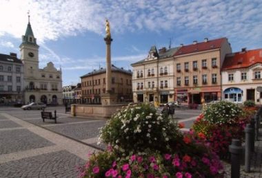
I suggest that you stay in the Turnov; it is centrally located in a beautiful region, and the town will be a good homebase for your hikes. You can do some hikes directly from Turnov, and others start a short bus or train ride away. You will get to Turnov easily by bus directly from Prague. The bus goes each hour. Of course you can choose accommodations yourself. If I can give you a tip, you can stay in the Hotel Karel IV.. This hotel is located close to the city center and the bus station.
I recommend visiting the Info center at the square. They will help you with details and also they can find the bus and train connections for the following days. Also, you can buy guidebooks and maps there.
Ideas for hiking trips:
Hrubá Skála area – take bus from Trutnov to Hrubá Skála (15 minutes drive), visit Hrubá Skála castle. To keep you out of the road you can use the blue path for a few steps and then swich for the red again. Enjoy the nice views. Then you will continue on the red trail to Valdštejn castle. Then you will continue to Hlavatice view point. On the way you can turn off few step to see Kalvarie. From here it is about 1.5 mile to the city center.
This tour is about 4 miles only, but you’ll be walking between rocks and sometime climbing up. Including the time to get there and see both castles, you will have a nice one day trip. Detailed map is here. To see it better, zoom it out or in.


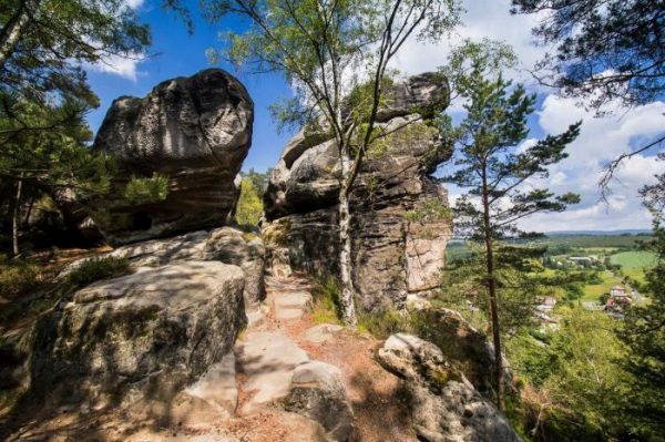
Klokočské skály area – this is a really great area to walk, especially if you are not afraid of stepping away from the marked trail :-). This area is full of beautiful valleys between rocks where you can find many places where Czech Tramps built their camps. From the town square you will go on the yellow trail. It will takes you all the way to the rocks. If you can, take a flashlight with you, because on the way you can visit Postojna cave. It is not a large cave, more or less a larger gap. Then you will continue on the yellow trail to the castle ruin Rotštejn. Again, you will see some nice views. From here you will come back on the yellow trail to the crossing with red trail and will switch for it. On the red trail you will enjoy even more views. Here you can enjoy narrow passages. The red trail will takes you all the way back to the city center.
This tour is about 8.5 miles long and you should save a whole day for it. If you want to make it shorter, skip the Rotšten castle and turn from yellow to red trail immediately. This will save you about one mile. Detailed map is here.
Frýdštejn and Vranov Rock Castles – this trip will takes you to two medieval castles built on rocks. Be careful about dates. Both castles are closed on Mondays. I recommend taking a train from Turnov to Malá Skála. The train goes often and the trip takes just a few minutes. From the train station you will go on the yellow trail to the center of village. There is very famous restaurant (U Boučků) that you should visit when you’re coming back. From here you change for the blue trail and cross the river. Then you will walk up till you reach the red trail and will turn right onto it. You will have great views again. After you reach the asphalt road you will use it to go to Voděrady and then to Frýdštejn. Don’t be worried about it – this is a very small road without any traffic. Just stay on the red trail. Then you will enter Frýdštejn. Do not miss the great tower. Here you can see the view from there. If you stay on the red trail, you will get to Vranov (sometime it is called Panteon). On the way you will need to climb some wooden ladders. The red trail will brings you back to the restaurant U Boučků. I have also a video from this area. It is in Czech but you are interested in pictures… The restaurant in the video is the one – U Boučků. For the video click here.
This hike is about 5 miles of walking but in terrain. In short, you can spend an entire day here. Detailed map is here.


Hike on the Jizera riverside – from Turnov you can go by bus or by train to Semily. In both cases it is about 30 minutes drive. You will follow the blue trail heading north to get out from the city. By the river you will switch to the red trail and cross the river. You will be walking right next to the river. The river is very romantic here, but probably too cold to swim. Finally you will reach Spálov where is the junction of Jizera and Kamnice rivers. Here is a restaurant if you want to rest. If you’re tired already, you can take a train from here back to home. If you want more, I recommend continuing on the blue trail, walk up to Spálov village and continue to the ridge. You will visit Myší skála. On the photo it may looks dangerous, but is not. There is a regular path to walk up. Then you will switch for yellow trail and keep walking. On the way you will pass many view points. Finally you will meet the red trail again and finish the circle. Cross the river and return to the train on bus station.
The whole hike is about 8 miles. Including the transfer from and to Turnov it is one full day as well. Detailed map is here.
I hope this information will help you. If you have any questions, send me an e-mail. Happy hiking.
